
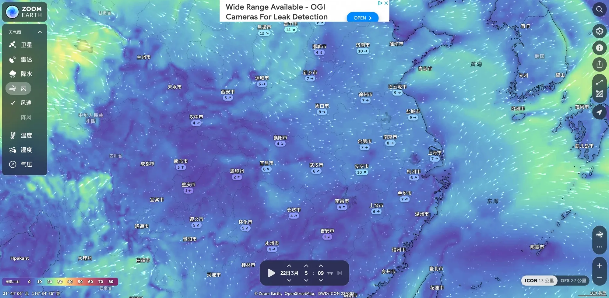
Real-time Global Weather Map
Explore current weather through interactive maps of rainfall, wind, temperature, pressure, etc., and view weather forecasts for your location. You can track the development of hurricanes and storms, monitor wildfires and smoke, and stay informed about the latest conditions by viewing near real-time updated satellite images and rainfall radar.
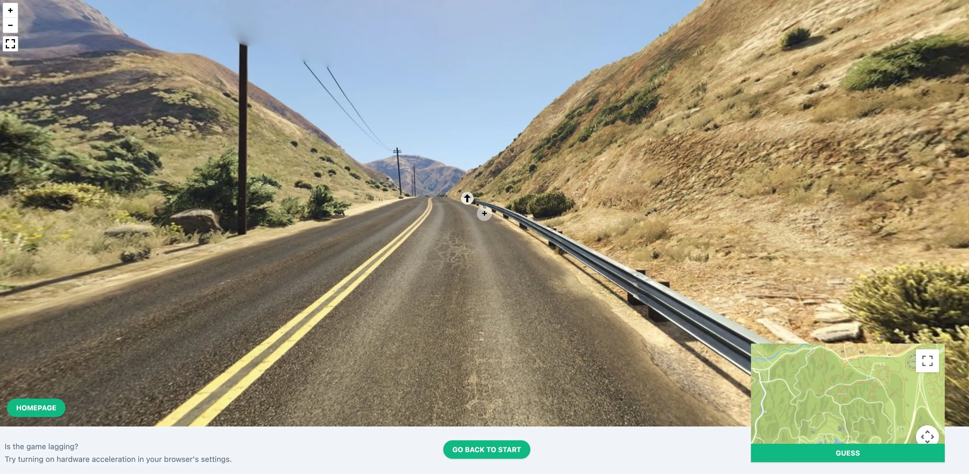
GTA Geography Quiz
The game screen provides no information except street view images and a compass. Players need to determine the location through information such as road signs, vegetation, commerce, climate, and landmarks. Players can also get more information by moving, panning, and zooming the street view.
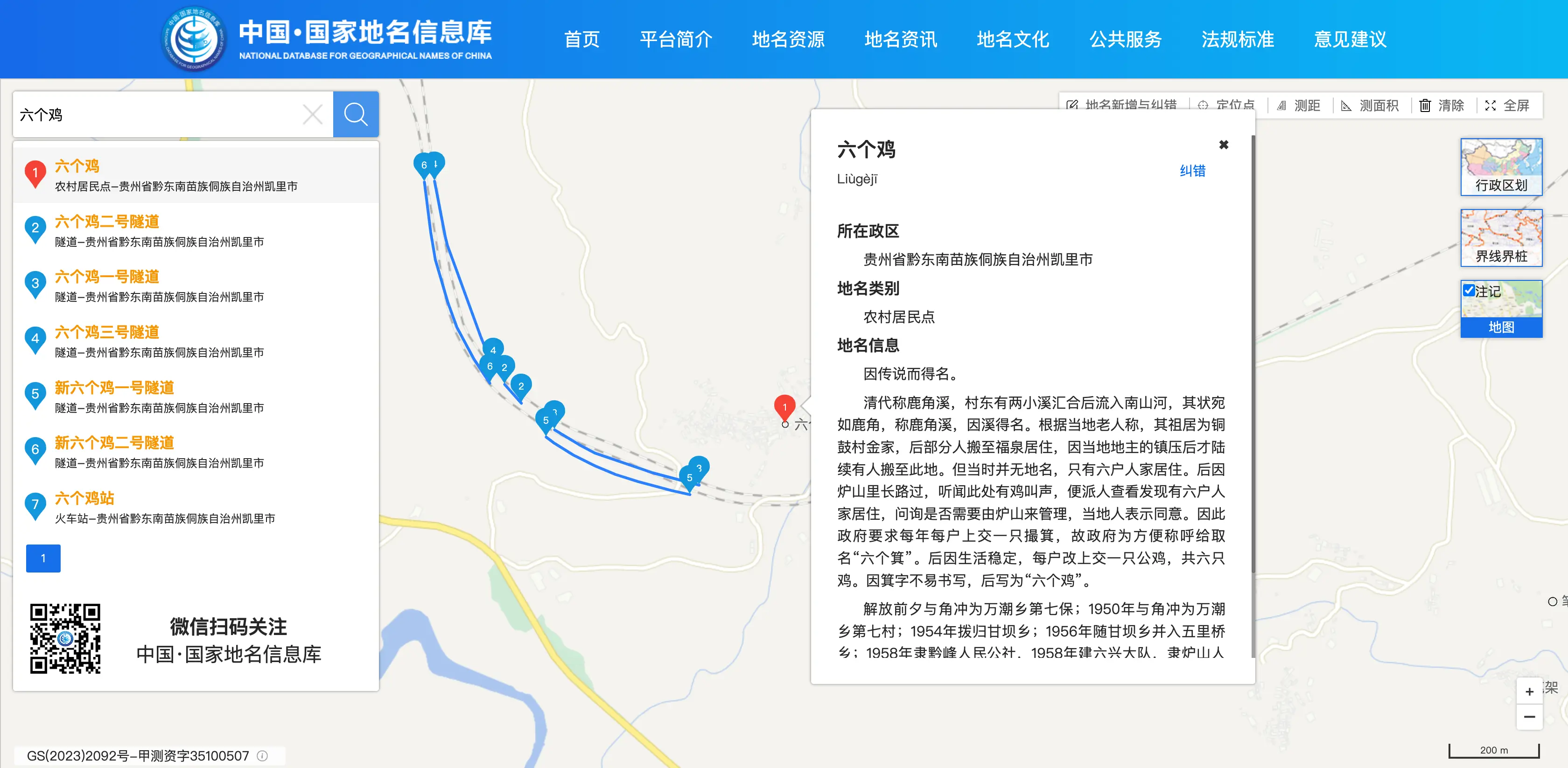
National Geographic Names Information Database
This national government department builds and maintains a geographic names information database. This database is not simple - it can look up all standard place names in China, including foreign, undersea, Antarctic and Arctic, and even lunar place names. It's like a comprehensive business card collection of the global village, where you can not only look up place names but also download administrative division data and understand the cultural stories behind place names. For example, if you want to look up the standard name of "Yellow River" or understand the origin and historical background of a place name, you can find answers here.
OCEARCH
Track the global trajectories of marine life such as great white sharks and killer whales through satellite positioning, providing scientific data on animal weight/age, with each animal having its own documentary and conservation story page.
![]()
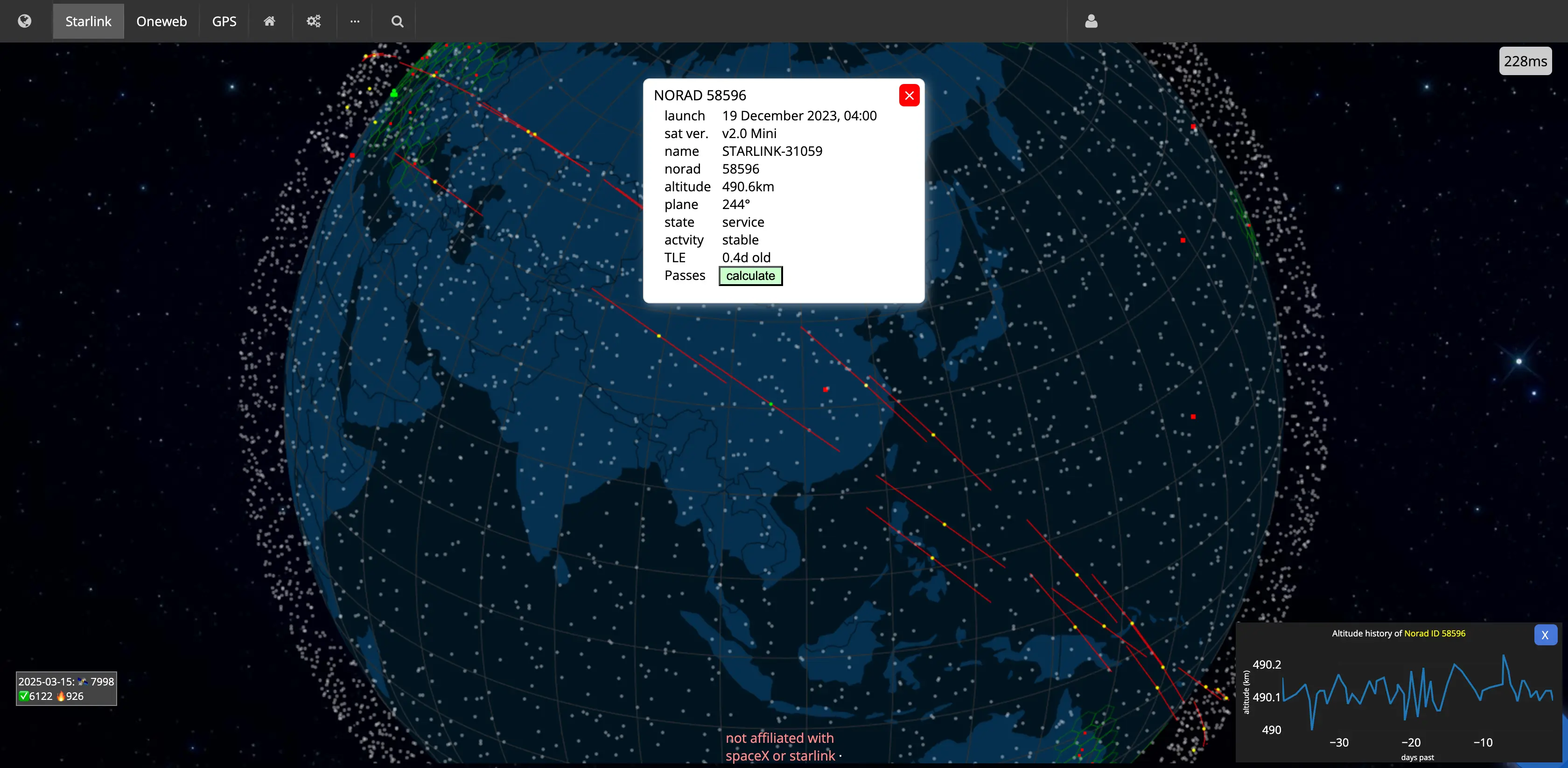
Satellite Map
Displays real-time positions and coverage of Starlink, Oneweb, and GPS system satellites, helping users understand the distribution and density of man-made satellites above Earth. The website provides an intuitive map interface that allows users to view satellite positions and trajectories in real-time, providing valuable information for both astronomy enthusiasts and general users.
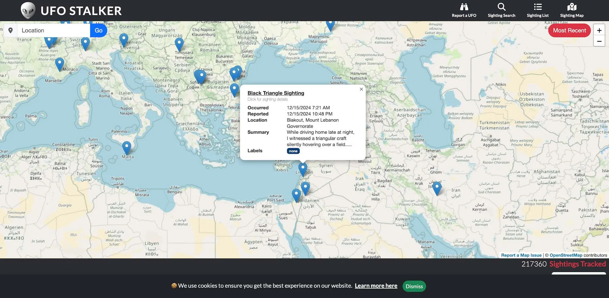
UFO Stalker
UFO event database based on GIS geographic information system, supporting spatiotemporal data visualization and analysis. Provides multi-dimensional information such as event details, photos, and videos, integrating event reporting submission and verification systems.
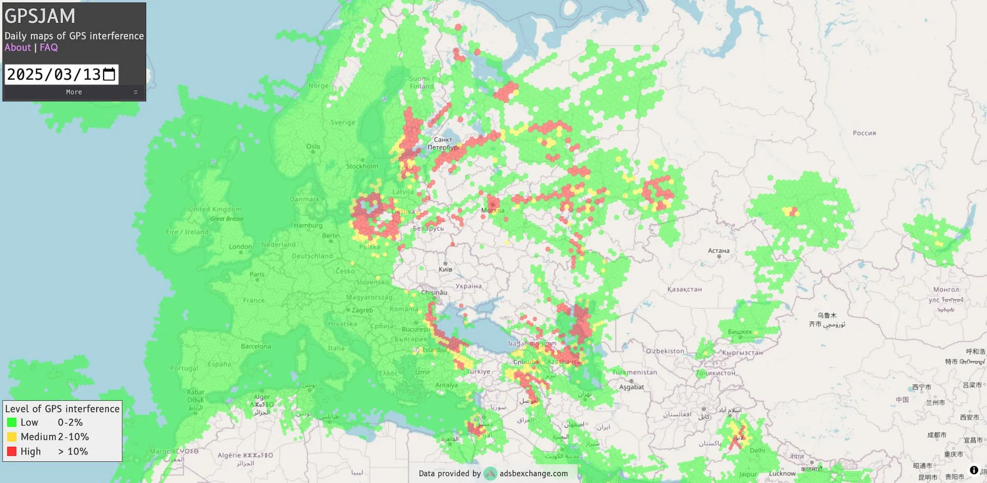
GPSJAM
Through this map, you can view the navigation accuracy of aircraft worldwide. Green indicates good accuracy, while red indicates low accuracy, giving you a clear view of GPS interference situations around the world.
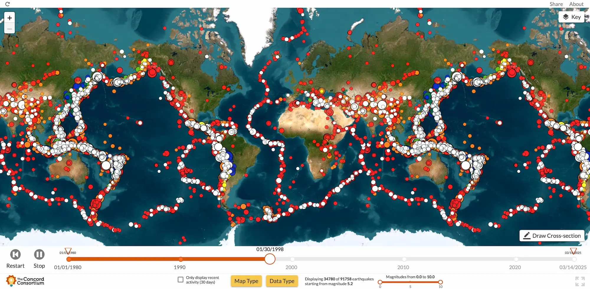
Global Earthquake Information
Seismic Explorer displays global earthquake data since 1980, allowing users to view earthquake activities and epicenter locations worldwide, and understand continental plate distribution, thus identifying whether their region is earthquake-prone.
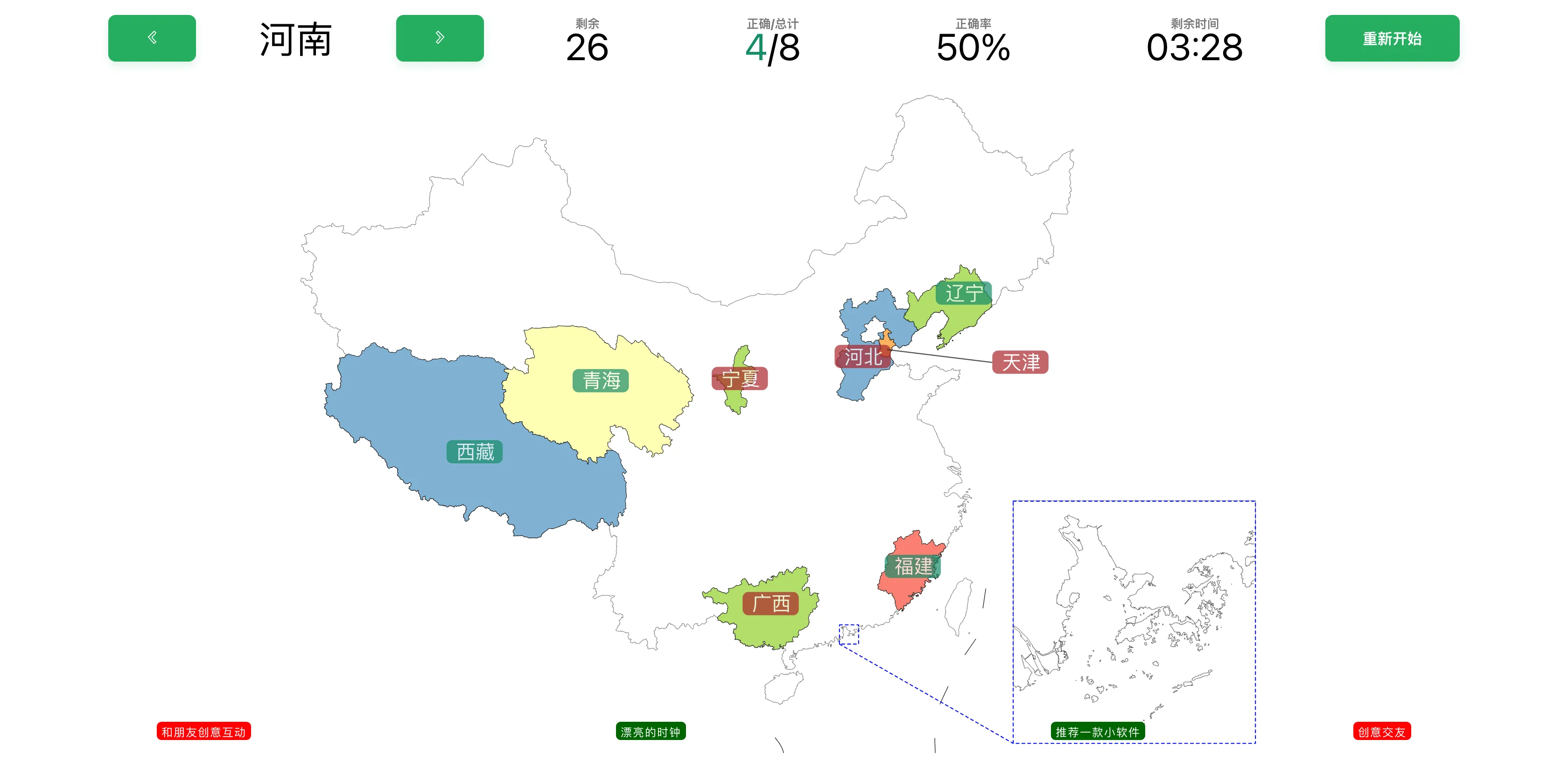
Chinese Provinces Test
Are you really familiar with the geographical locations of China's provinces? Try this interactive test by clicking on the correct provinces to complete the challenge and see how your geography knowledge measures up! The game starts with a Chinese map outline, and you need to click on the approximate location of the prompted province with your mouse to see how many you can get right.
Want to explore more weird websites? Click below button to discover more!